Drone photogrammetry: a measurable map and model of your site.
Low-altitude aerial capture turned into an orthomosaic, a point cloud and a terrain model — in RD/NAP, with the accuracy stated per delivery. Based in Waalwijk, operating across the Netherlands.
Aerial photography for marketing — real estate listings and events — remains available as a separate track. Flights over crowds are not offered in the Open category; productions that require it are handled under a Specific category operational authorisation (longer lead time).
From a recent capture
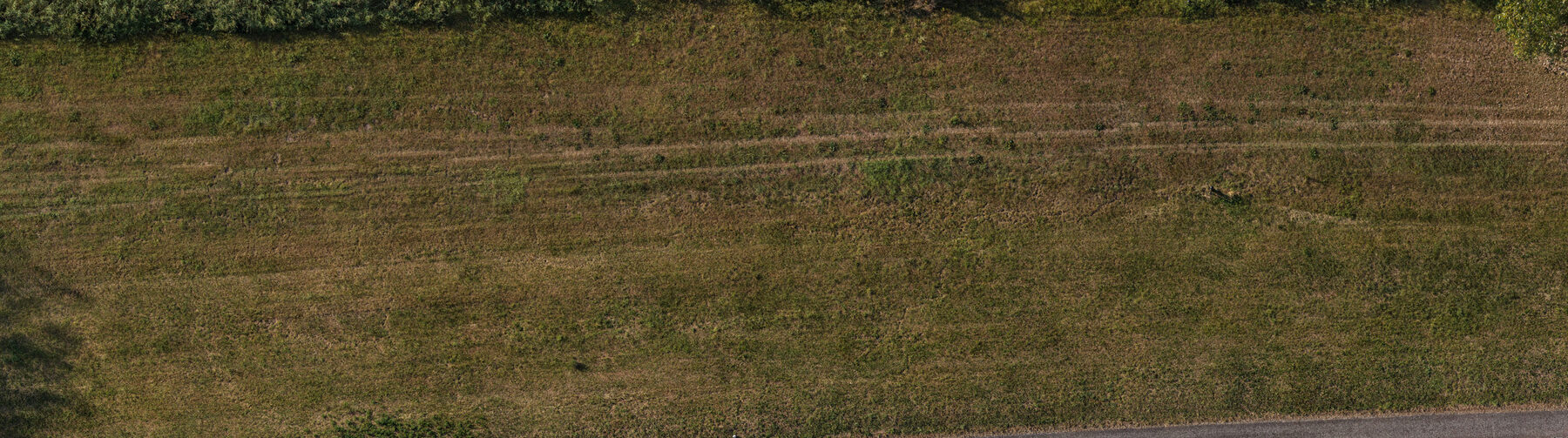
Part of the orthomosaic from a dike corridor survey near Doeveren, Noord-Brabant — 288 m of crest, flown in two blocks at roughly 18 m, nadir. This is not an aerial photograph: it is the frames covering this strip reprojected onto the reconstructed ground surface, which is why the mowing tracks, the vegetation edge and the maintenance path all sit where they actually are.
Flown 14 Aug 2026Reconstructed 2,246 of 2,250 imagesOrtho 5.0 cm/pxReprojection error 1.22 pxGNSS residual CE90 4.41 mGround control none
No ground control was laid on this flight, so absolute position carries the GNSS offset above — and no heights were published from it, because the reconstruction would not have survived a check against AHN. That is the same standard applied to every delivery, and it is why the numbers are on this page rather than only in our own files.
What you receive
OrthomosaicGeoreferenced GeoTIFF (cloud-optimised on request), typically 2–5 cm/px depending on flight height and required detail.
Point cloudLAZ for your surveyor, plus a web-streamable copy so the model opens in a browser without software.
Terrain & surface modelDSM/DTM raster and contours, in NAP heights — delivered when the reconstruction supports them and survives an independent check.
3D meshTextured OBJ or GLB on request, for visualisation and design context.
Private web viewerA password-protected page per project: pan and zoom the survey, switch photo against terrain, measure distance and area in the browser, download every file.
Quality reportImages used, ground sample distance, reprojection error, GNSS residuals (CE90/LE90), reconstructed extent and the checks performed.
What "measurable" means here
Relative accuracy
Distances and areas within one flight are consistent to a few centimetres, set by ground sample distance and reprojection error. Both are stated per delivery, not assumed.
Absolute position
Without ground control, position comes from the aircraft's own GNSS — metres, not centimetres. Every delivery publishes its CE90/LE90 rather than a marketing figure.
Ground control
Surveyed markers (GCPs) and a tape-measured baseline are laid on request, for work that has to be right in absolute terms and not only internally consistent.
Heights
Published only when the dense reconstruction supports them and they check out against AHN. Where that check fails, heights are withheld and the delivery says so.
A survey that cannot be checked is not a survey. Where a result is corroborated rather than proven, the delivery states which, and by what evidence.
How we work
1. Scope
Area, what has to be measurable, coordinate system, and whether ground control is needed. Lead time and flight framework confirmed up front.
2. Capture
Flight height and overlap planned for the target resolution — nadir grid, crosshatch or oblique as the object requires. VLOS, daytime, within EASA and local restrictions.
3. Processing
Photogrammetric reconstruction, then quality control: reprojection error, GNSS residuals, and a horizontal check against public reference data (PDOK/AHN) where coverage allows.
4. Delivery
Private viewer plus the raw files, in the formats your surveyor, contractor or designer asks for. Typically within five working days of the flight.
About
Vhaelum Aerial is a Netherlands-based drone operator located in Waalwijk, registered with the RDW and operating in the A1 Open category with a sub-249g aircraft. Productions that fall outside the Open category are handled under a Specific category authorisation. Working across the Netherlands.
Capture and photogrammetric processing are run in-house on an open, auditable pipeline. You receive the outputs and the numbers behind them — not a rendered picture with the workings removed.
Contact
For project enquiries — include the site, roughly the area in hectares, and what has to be measurable: